

The Science Behind Heritage Scanning with LiDAR
In the ever-evolving landscape of technology, one innovation stands out for its transformative impact on historic preservation: the LiDAR scanner. This powerful tool redefines how we approach the heritage scan process, from dense jungles hiding ancient cities to fragile architectural relics in urban centres.
But what exactly is LiDAR, and how does it work in the context of cultural and historical preservation? Let’s examine the science, significance, and future of using LiDAR to digitise our shared heritage.
What is LiDAR?
LiDAR, short for Light Detection and Ranging, is a remote sensing technology that uses laser pulses to measure distances to surfaces. These measurements create incredibly accurate, three-dimensional representations of physical environments, including terrain, buildings, and even underground features when vegetation is present.
A LiDAR scanner emits rapid laser pulses, often hundreds of thousands per second. When these pulses hit an object, they bounce back to the scanner, which records the time it took for the light to return. This information is then translated into precise distance measurements.
Why LiDAR for Heritage Scanning?
Traditional methods of surveying historical sites — such as manual measurements, hand-drawn sketches, and photogrammetry — are often time-consuming, invasive, and limited in accuracy. In contrast, a heritage scan using a LiDAR scanner provides:
- Speed: Entire landscapes can be scanned in a fraction of the time of traditional methods.
- Non-invasive analysis: Delicate artefacts and fragile structures are documented without physical contact.
- Data richness: The collected data enables comprehensive analysis, virtual reconstruction, and predictive modelling.
These benefits make LiDAR especially valuable for projects where preservation and minimal disturbance are critical.
Applications in Heritage Projects
Across the globe, LiDAR scanning is being used in innovative ways to uncover, preserve, and study cultural heritage:
- Revealing lost cities: LiDAR scans through dense rainforest canopies revealed entire Mayan cities previously unknown to archaeologists in Central America. The technology uncovered vast urban networks, roads, and fortifications beneath thick vegetation.
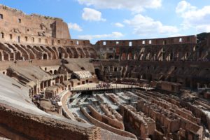
- Mapping ancient monuments: In Europe and Asia, many historic castles, churches, and temples have undergone heritage scans to document their condition. These digital models help conservationists monitor structural changes over time and plan restoration work with surgical precision.
- Creating digital twins: In the Middle East, war-torn heritage sites like Palmyra have been scanned using LiDAR to create digital twins. These models preserve cultural identity, allow virtual tourism, and offer a blueprint for future reconstruction efforts.
The Workflow of a Heritage Scan
A typical heritage scan using a LiDAR scanner involves several key stages:
- Pre-scan planning: Experts assess the site, determine scanning positions, and consider environmental factors.
- Data capture: The site is scanned using a terrestrial or aerial LiDAR scanner (e.g., drones, tripod-mounted units). Each laser pulse that returns adds a point to the digital map.
- Post-processing: The raw point cloud data is cleaned, filtered, and stitched together. This step often includes removing noise, aligning scans, and adding colour data from accompanying photography.
- Analysis and modelling: The point cloud is used to build 3D models, which can be interpreted, annotated, or integrated into Geographic Information Systems (GIS) for further research.
- Preservation and sharing: The final models can be archived, shared with academics or the public, and used in virtual exhibitions or educational resources.
Challenges and Considerations
Despite its advantages, LiDAR scanning isn’t without challenges. Cost can be a barrier, particularly for smaller institutions. High-resolution scanning equipment and the software required for processing are significant investments. Additionally, interpreting massive datasets requires expertise in both heritage and digital technologies.
Environmental conditions like extreme weather or dense undergrowth can also affect scanning quality. However, advancements in portable scanners and AI-assisted data processing are helping address these limitations.
The Future of Heritage Preservation
As the demand for cultural preservation grows, LiDAR is expected to become a cornerstone technology in heritage documentation. Emerging trends include:
- Integration with AI to automatically detect patterns or structural weaknesses in scanned data.
- Augmented reality (AR) experiences built directly from LiDAR scans for immersive education.
- Cloud-based collaboration tools allow researchers worldwide to interact with heritage scan models in real time.
LiDAR technology doesn’t just help us see the past—it helps us understand, protect, and connect with it in never-before-possible ways.
In the realm of heritage preservation, the LiDAR scanner is not just a tool—it’s a bridge between the past and the future. Through highly detailed heritage scans, we can capture the stories etched in stone, earth, and architecture before they fade away. As we continue to digitise history, one laser pulse at a time, we move closer to a world where knowledge of our cultural legacy is accessible to all and preserved for generations to come.